 Hikes
Hikes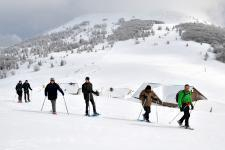 Mountain leaders
 Around us
")

")
Walking tour: The Molkenrain tour via the summit
Nearest train station :
14 km - Cernay


About the walk
path
Start :
Uffholtz Route des Crêtes - Col du Silberloch
Altitude difference :
400 m
Length :
7,3 Km
Useful information
hiking path
IGN walking map needed :
1/25000 3620 ET
Marking :
Difficulté : intermédiaire

To access the staring point of this walk, take the Peaks Route, touristic route of the mountains, which crosses the Vosges to the Silberloch pass. then set off through forest and stubble fields to discover beautiful panoramas around the Freundstein or the Molkenrain. The summit walk!